
Pixy LR SP with TAG-E
Smart Geotagging. Faster Mapping & Inspection.
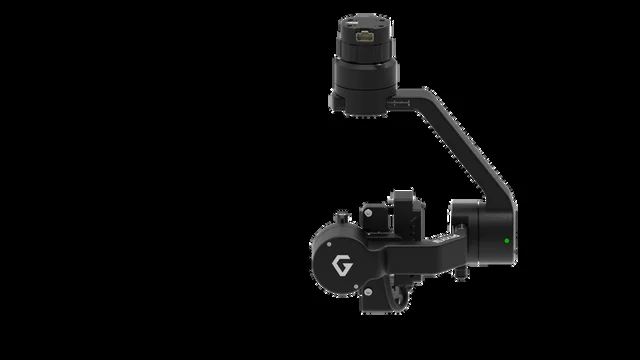
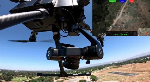
Your trusted Pixy LR SP gimbal is now powered with TAG-E. Purpose-built for the Sony ILX-LR1, it captures precise, geotagged imagery straight out of the flight so your team maps and inspects faster, with less time spent in post-processing.
Why TAG-E?
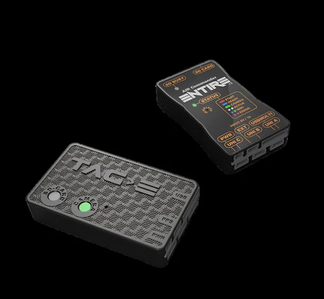
TAG-E is the latest geotagging module developed by AirPixel (Czech Republic). It records accurate position and time data (GPS, IMU and flight telemetry) for every image captured in flight, and embeds it directly into the image metadata.
The result: high-accuracy maps and 3D models with far less time spent in post-processing. Designed specifically for the Sony ILX-LR1, TAG-E replaces complex, multi-option setups with a streamlined configuration that works right after connection.
Built-in Intelligence
Everything TAG-E automates so your pilots capture mission-ready data on the first flight.
SRT Movie Geotagging
Writes GPS, speed, heading and telemetry into the video SRT file for geo-referenced footage.
PPS GPS Time Sync
Pulse-Per-Second synchronization aligns camera time to GNSS/RTK for centimeter-grade RTK/PPK.
Full MAVLink Configuration
Configure every TAG-E parameter over MAVLink from your Ground Control Station.
MAVLink Camera Protocol v2
Full v2 support for shutter, capture, status, storage and zoom control across PX4 and ArduPilot.
Automatic Camera Clock Sync
Auto-syncs the Sony ILX-LR1 clock to GPS time on every startup for accurate geotagging.
Remote SD Card Formatting
Format the camera SD card remotely over MAVLink, saving prep time before each mission.
Base vs TAG-E
Same trusted Pixy LR SP airframe. A simpler, faster path to geotagged data.
- Complex configuration with many options
- Tuned for a wide range of cameras
- More setup steps before first flight
- Streamlined configuration, ready right after connection
- Purpose-built for the Sony ILX-LR1
- Geotagged data straight out of the flight
Technical Specifications
Made for Mapping & Inspection
With geotagged imagery captured in flight, Pixy LR SP with TAG-E turns raw survey data into accurate deliverables faster - ideal for demanding photogrammetry and asset-inspection missions.
Mapping / Surveying
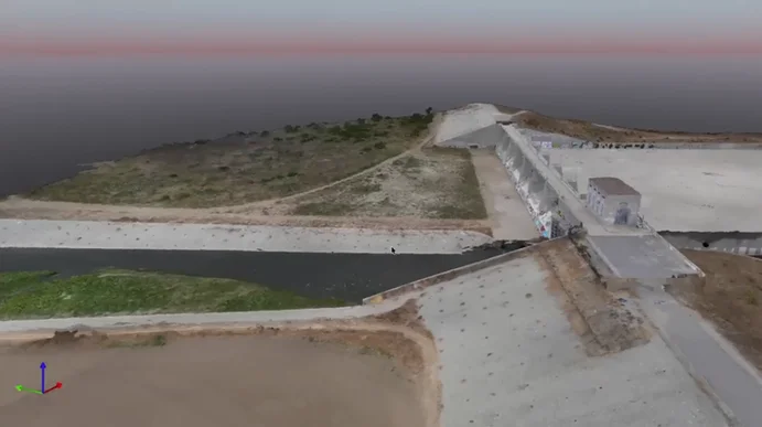
High-accuracy orthomosaics and 3D models with minimal post-processing.
Inspection
Geo-referenced imagery for infrastructure and asset inspection.
Flyby Robotics
Flyby Robotics uses Pixy LR SP for mapping with Smart Oblique Mode - delivering a stable, smooth mapping experience across demanding survey missions.
Combined with TAG-E geotagging, teams move from flight to deliverable with fewer manual steps and higher confidence in the data.
Expandable with Dovetail Mounting
Pixy LR SP with TAG-E pairs with the Dovetail Adapter for even faster deployment - purpose-built for smarter mapping workflows in the field.
Ready for Immediate Use
Purpose-built for the Sony ILX-LR1 with TAG-E geotagging integrated. Attach it to your drone and start capturing mission-ready data - no complex integration required.
Leave your details and place your pre-order today.
Pixy Line for Sony Cameras
 Pixy LR S-Port
|
 Pixy LR
|
 Pixy S
|
 Pixy SM
|
|
|---|---|---|---|---|
| Supported Camera | Sony ILX-LR1 | Sony ILX-LR1 | Sony A7R IV / A7R V | Sony A7R IV / A7R V |
| Weight | 462g (1lb) | 495g (1 lbs) | 560g (1.2 lbs) | 570g (1.26 lbs) |
| Dimension (D×W×H) | 140 × 115 × 183 (mm) | 140 × 115 × 200 (mm) | 140 × 127 × 183 (mm) | 147 × 157 × 190 (mm) |
| Supported Lenses | SEL35F28Z, SEL35F18F, SELP1635G, SEL28F20, SEL55F18Z, SEL85F18*, SEL24F28G, SEL50F25G, SEL40F25G | SEL35F28Z, SEL35F18F, SELP1635G, SEL28F20, SEL55F18Z, SEL85F18*, SEL24F28G, SEL50F25G, SEL40F25G | SEL28F20, SEL35F28Z, SEL55F18Z, SEL24F28G, SEL40F25G, SEL50F25G | SEL28F20, SEL35F28Z, SEL55F18Z |
| Drone Platforms | Pixhawk / CubePilot | Pixhawk / CubePilot / Skynode / M600 / Airpeak | Pixhawk / CubePilot / Skynode / M600 | M300 M350 (in development) |
| Connections | ||||
| USB | N/A (integrated with Entire) | 3.0 | 2.0 | 2.0 |
| CAN | ||||
| AUX | 4 signals | 4 signals | 4 signals | |
| UART | ||||
| HDMI | (**) | |||
| SBUS / PPM | N/A | |||
| Damping | Pixy S / LR - Damping | Pixy S / LR - Damping | Pixy S / LR - Damping | Pixy SM Advanced Damping |
| Quick Release | S-Port (Mio Quick Release) | Hyper Quick Release 3.0 | HDMI Hyper Quick Release V2.0 | DJI Skyport V2 |
*Photography only | **Video stream via DJI Skyport V2
Request received
Thank you. Our team will review your request and get back to you shortly.